Urban Tree Counting
Urban tree count is becoming essential for modern cities. This article explains how GIS and satellite imagery help track, monitor and manage urban forests at scale.
Categories:
Date Posted:
July 3, 2025
Urban Tree Counting with GIS and Satellite Imagery: A Foundation for Greener Cities
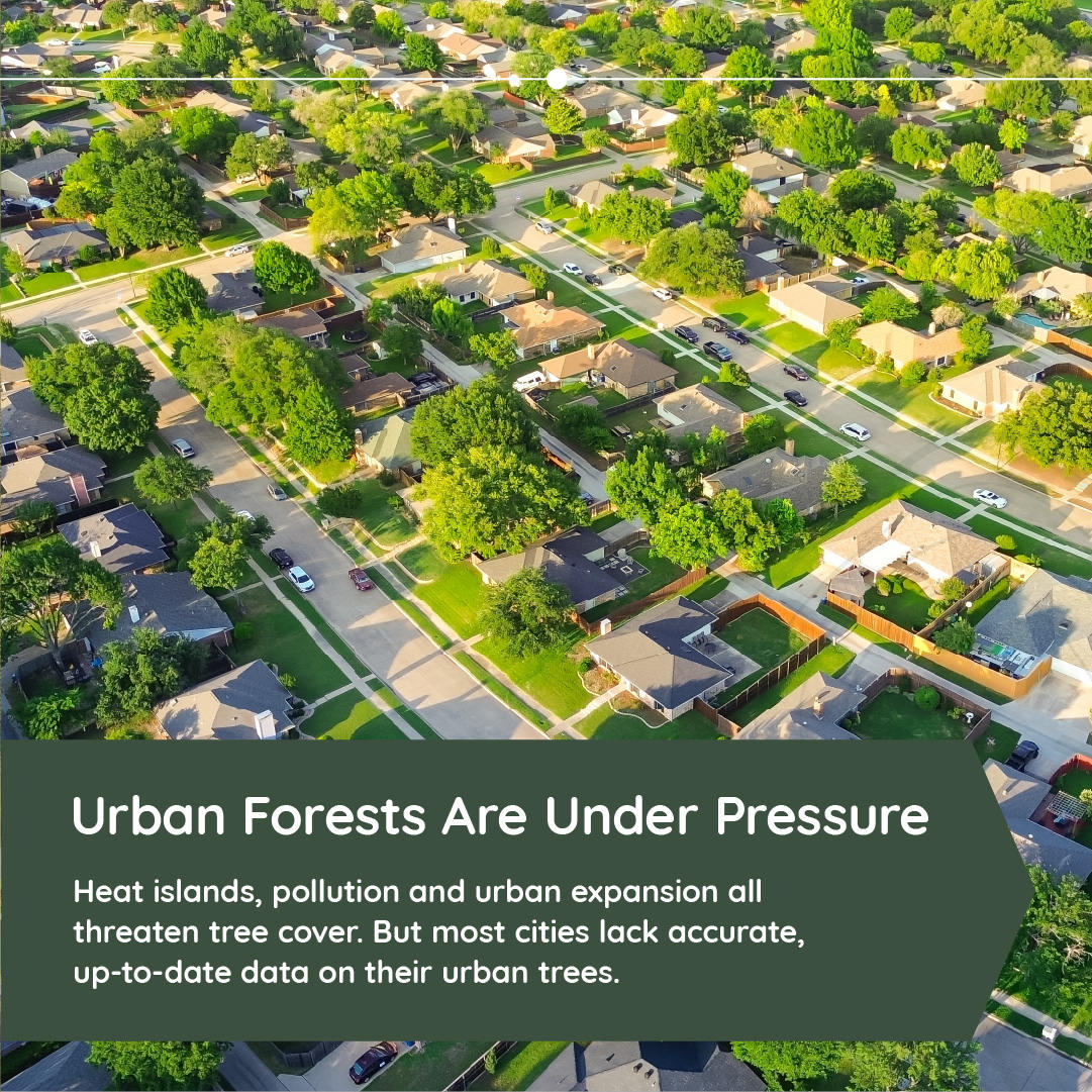
Urban trees play a critical role in the health and resilience of cities. They provide shade, cool urban surfaces, reduce air pollution, support biodiversity, and contribute to both physical and mental wellbeing. Yet many cities lack a clear and current urban tree count, leaving planners and policymakers without the data needed to manage these valuable natural assets. As urban landscapes continue to expand and change, maintaining an accurate urban tree count has become essential for sustainable city planning, climate adaptation, and green infrastructure management.

The Importance of Urban Tree Data
Urban trees are not simply decorative features. They form a vital part of a city’s living infrastructure, offering services that are measurable, impactful and increasingly indispensable to modern urban life. From moderating temperatures and improving air quality to managing stormwater and supporting biodiversity, trees contribute directly to the sustainability, health and livability of cities. Yet for many municipalities, a lack of reliable and current data stands in the way of unlocking these full benefits. Accurate knowledge of tree numbers, location, size, species and health is necessary for effective management and long-term planning. Without a dependable urban tree count, city officials are often forced to work with outdated estimates, incomplete records or inconsistent survey data. This limits the ability to plan green infrastructure, monitor change, and make data-informed policy decisions.
One of the most widely recognised benefits of urban trees is their ability to reduce temperatures in built environments. Tree canopies provide natural shade that lowers surface and air temperatures, helping to mitigate the urban heat island effect. In dense cities where hard surfaces dominate, this cooling effect becomes essential in improving thermal comfort, especially for vulnerable populations such as the elderly or those without access to air conditioning. Alongside cooling, trees play a critical role in air purification. Their leaves capture airborne pollutants, including nitrogen dioxide, sulfur dioxide and fine particulate matter. This process improves the quality of the air residents breathe, contributing to lower rates of respiratory illness and enhancing overall public health.
Urban trees also assist with stormwater management by intercepting rainfall on their leaves and branches. This slows down water flow, reducing the volume of runoff entering drainage systems during heavy rain events. In doing so, trees help cities manage flood risks and reduce the burden on stormwater infrastructure. Additionally, urban forests store carbon in their biomass. While they do not match the scale of carbon sequestration achieved by large natural forests, urban trees still make a meaningful contribution to climate mitigation efforts, especially when planted and maintained as part of larger greening strategies.
Beyond environmental functions, urban trees enhance ecological diversity. They create microhabitats for a wide variety of bird species, insects and small mammals, supporting pockets of biodiversity within dense urban environments. These green corridors also connect parks and open spaces, enabling species movement and increasing ecosystem resilience. Furthermore, the social and psychological benefits of trees are well documented. Access to green spaces, including tree-lined streets and shaded walkways, has been linked to reduced stress levels, increased physical activity and improved mental wellbeing. Trees provide aesthetic relief from concrete landscapes, contribute to a sense of place, and encourage outdoor activity.
To manage, protect and expand these benefits, cities must have an accurate and up-to-date understanding of their tree population. Knowing how many trees exist, where they are located and what condition they are in forms the baseline for all other action. A detailed urban tree count, supported by geospatial technologies such as GIS and satellite imagery, provides this foundational knowledge. With accurate data, cities can track changes over time, assess the impact of planting programs, and respond quickly to threats such as disease outbreaks or infrastructure developments that affect tree cover.
In the face of growing environmental pressures and rapid urbanisation, investing in reliable urban tree data is not a luxury. It is a necessity for resilient, sustainable and livable cities.

Traditional Challenges in Urban Tree Inventories
Urban tree inventories have traditionally relied on ground-based field surveys, where arborists or municipal teams walk through city streets, parks and open spaces to manually record information about individual trees. This process includes documenting the species, measuring trunk diameter, estimating canopy spread, noting the health condition, and capturing the tree’s precise location. On a small scale, these inventories can yield detailed and valuable insights. However, the method quickly becomes impractical when applied to large urban areas or when frequent updates are required. The time, labour and cost involved in manually surveying thousands or even millions of trees presents a major challenge, especially for cities with limited capacity.
In fast-growing urban environments, development often outpaces data collection. New roads, housing projects and commercial expansions can result in tree removals or additions that go unrecorded for months or years. The longer the interval between surveys, the more outdated and unreliable the data becomes. Without an accurate and current urban tree count, city departments are unable to confidently evaluate the effectiveness of tree planting programs, measure canopy loss, or prioritise areas for greening interventions. In many cases, fragmented or incomplete records are stored in incompatible formats, further limiting their usefulness in city-wide planning or reporting.
Resource limitations compound the problem. Municipal governments, particularly in low- and middle-income regions, often lack the funding and personnel required to carry out comprehensive inventories. Even when surveys are completed, the ability to maintain the data and integrate it into wider planning systems is not guaranteed. As a result, cities are left with only a partial understanding of their urban forests, limiting their capacity to make evidence-based decisions.
These challenges have highlighted the need for faster, scalable and repeatable methods of data collection. Remote sensing and geospatial technologies have emerged as effective solutions, offering a way to analyse urban tree cover with greater accuracy, consistency and efficiency. By shifting the process from fieldwork to digital observation, cities can build robust, up-to-date inventories that support long-term environmental planning and urban resilience.

The Role of Satellite Imagery in Tree Counting
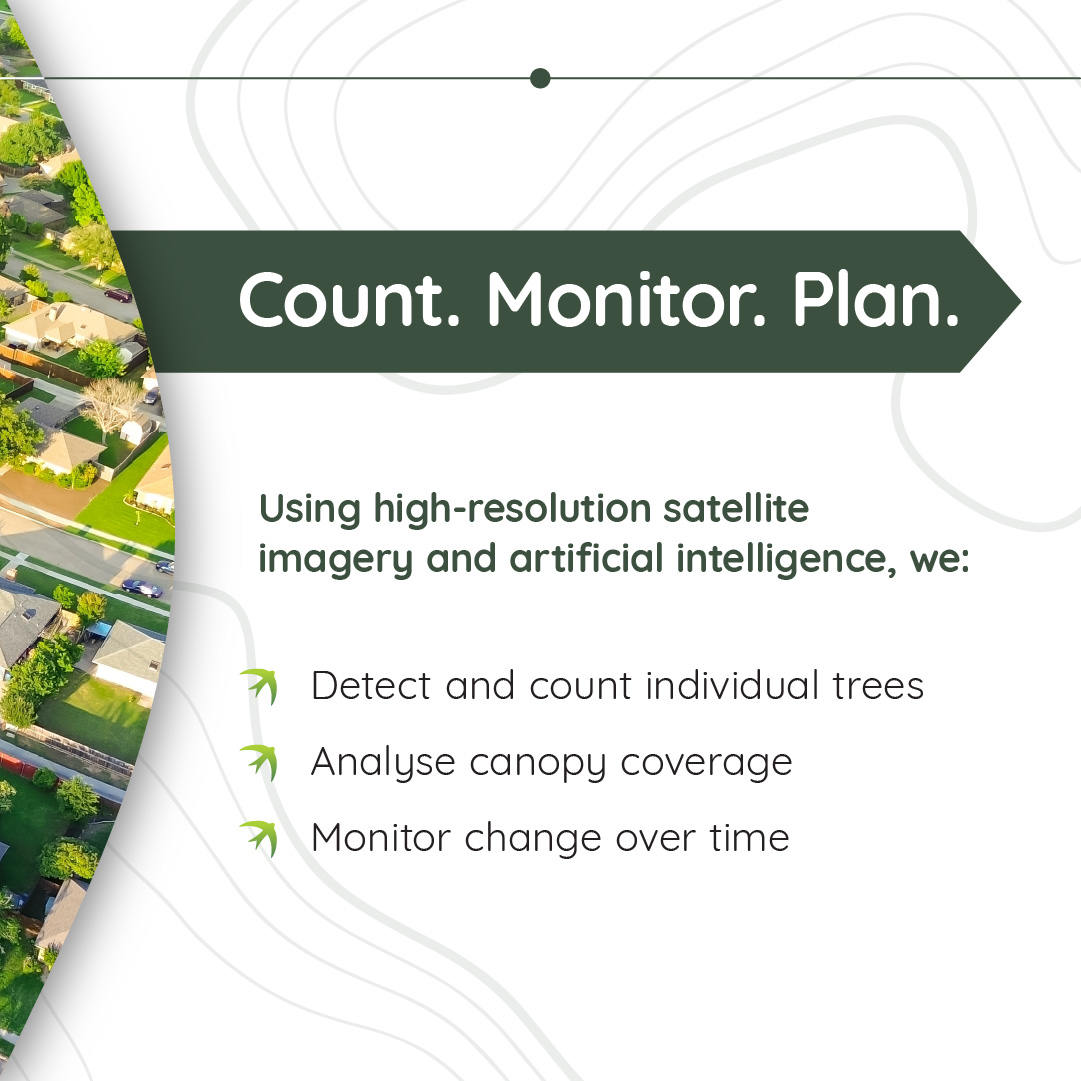
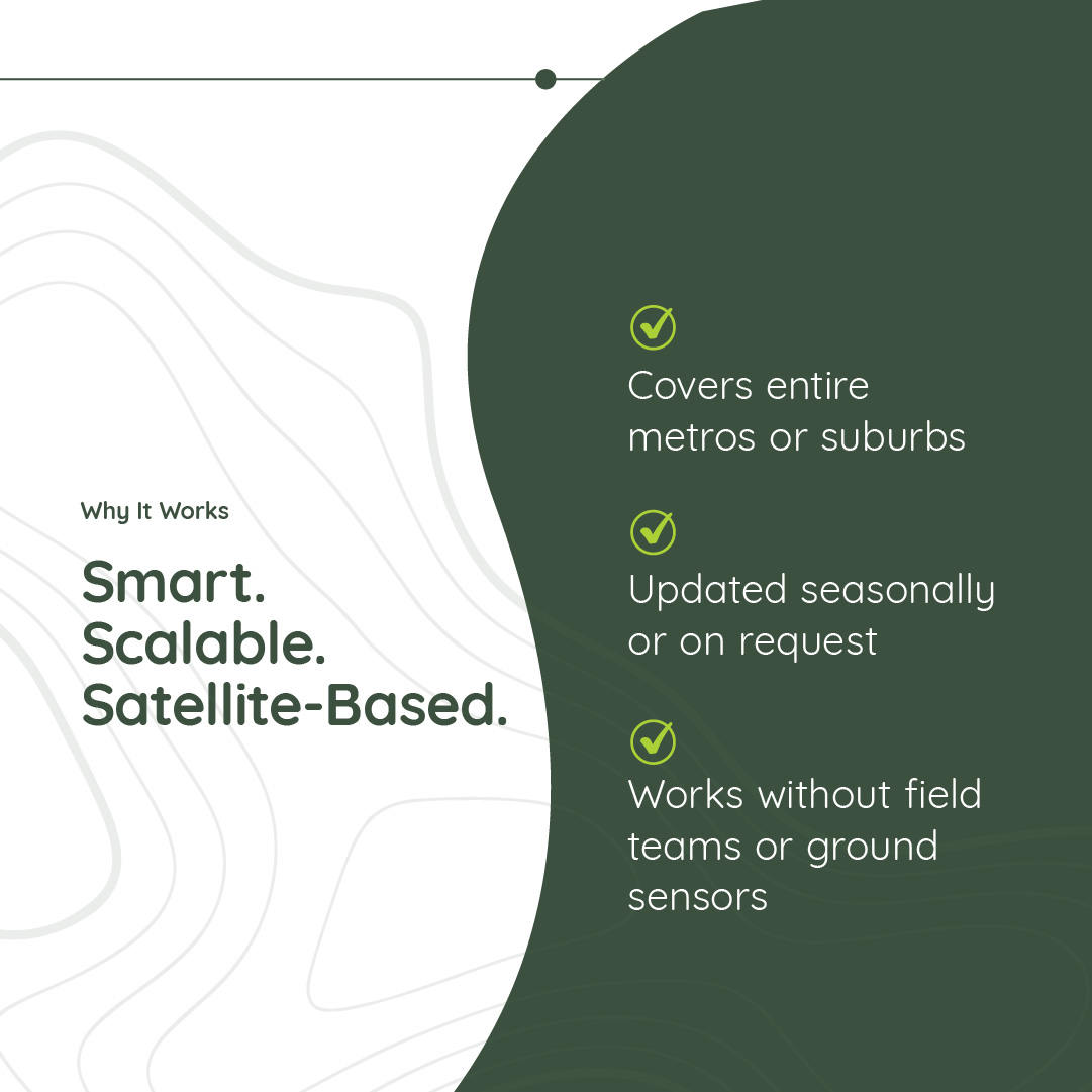
Satellite imagery offers a powerful, scalable and increasingly accessible method for conducting urban tree counts. Where ground surveys are limited by time, terrain and human resources, satellite-based approaches allow for comprehensive coverage of entire cities and suburbs in a fraction of the time. Modern high-resolution satellites can capture imagery with spatial resolutions as fine as 30 to 50 centimetres. At this level of detail, analysts are able to distinguish individual tree crowns from rooftops, pavements and other surface features. This makes it possible to detect and map trees in residential neighborhoods, along road verges, within parks and even in densely built environments where green cover is fragmented.
High-resolution Earth observation plays a central role in this process. Swift Geospatial works with leading imagery providers to task satellites capable of capturing very high-resolution data, including imagery at 15 centimetres per pixel. This spatial precision is essential for identifying individual tree crowns, even in complex urban settings with overlapping canopies, built-up structures or heavy shade. In addition to standard RGB imagery, Swift also integrates hyperspectral data at 5-metre resolution. These multi-band datasets, capturing between 4 and 26 spectral bands, allow analysts to assess tree vitality and assist in species classification. By examining subtle differences in reflectance signatures, it becomes possible to differentiate between types of vegetation and detect early signs of stress or disease.
Once the appropriate imagery is acquired, it undergoes pre-processing to correct for any geometric distortion, atmospheric haze or lighting variation that may affect analysis. These corrections ensure that the spatial and spectral information is consistent and reliable across the dataset. Advanced classification techniques are then used to isolate tree crowns. Spectral analysis, object-based image analysis and machine learning models such as convolutional neural networks all contribute to identifying tree canopy areas based on shape, texture and reflectance. Where possible, algorithms segment individual trees within larger clusters, assigning attributes such as location, crown diameter and canopy density.
Repeat imagery allows for time-series analysis. Cities can compare data across seasons or years to assess canopy gain or loss, track planting program outcomes, or identify areas where tree cover has been reduced due to construction, disease or climate impact. Since these methods are applied remotely, they offer a low-disruption, high-frequency solution to urban forest monitoring.
Satellite-based tree counting replaces fragmented and infrequent ground surveys with a reliable, updatable source of insight. It enables municipalities to understand the structure and condition of their urban canopy at a resolution and scale that supports informed planning, risk management and long-term environmental resilience.

Integrating AI into GIS for Deeper Insights
One of the most immediate benefits of GIS integration is the ability to visualise the spatial distribution of trees across a city.
While satellite imagery delivers the visual and spectral data needed to identify and count trees, it is Geographic Information Systems (GIS) that transform this information into actionable insight. GIS platforms allow urban tree data to be analysed in relation to a city’s infrastructure, environment and demographics. By bringing layers of data together, GIS reveals patterns that support more informed and equitable decision-making.
A key part of this integration involves artificial intelligence. The raw satellite imagery is processed using custom-trained deep learning models developed specifically for urban settings. These models are designed to navigate the visual complexity of cities, where trees are often surrounded by buildings, roads and dense infrastructure. The AI is trained to distinguish between planted trees, spontaneous vegetation and non-natural features, allowing for accurate identification of individual trees in areas where traditional classification methods may fall short. It recognises a variety of tree forms, including ornamental trees and palms that are common in urban landscaping but often missed in lower-resolution assessments.
The output from this analysis is a spatially explicit inventory that includes the precise location of each tree, an estimate of its crown diameter and a basic health assessment based on spectral data. This geolocated dataset can then be imported into GIS platforms for deeper interpretation. Within GIS, users can map tree distribution alongside indicators such as population density, heat exposure, flood zones or air quality levels. This allows planners to identify low-canopy areas, assess environmental inequality, or prioritise sites for intervention.
GIS is also used to support zoning and regulatory decisions, helping cities protect existing trees, plan new plantings or establish green buffers around critical infrastructure. When combined with temperature and impermeable surface data, urban tree inventories can be used to model cooling effects and stormwater absorption potential. This supports practical planning for climate adaptation.
In addition, tree health insights derived from AI and spectral data can be linked to infrastructure risk, helping maintenance teams monitor areas where ageing or stressed trees may pose a hazard. Over time, changes in tree condition and canopy size can be tracked, allowing cities to measure the effectiveness of planting campaigns or identify signs of decline.
Together, GIS and AI turn static imagery into a living management tool that supports more responsive, transparent and data-driven urban forestry. As these technologies continue to advance, they offer cities a clearer and more complete understanding of the role trees play in urban resilience and quality of life.

Species Classification and Individual Tree Health Monitoring
Species classification provides valuable insight into the composition of the urban forest. It enables cities to track the diversity of tree populations and to assess whether certain species are overrepresented or under threat from pests, disease or changing climate conditions.
Once individual trees have been mapped and geolocated, the next stage involves identifying their genus or species using spectral analysis. This classification process relies on hyperspectral imagery, which captures a wide range of narrow spectral bands across the electromagnetic spectrum. Different tree species reflect and absorb light in unique ways, particularly in the visible and near-infrared regions. By analysing these subtle differences in reflectance, it becomes possible to distinguish between species or genera with a high degree of confidence. This process allows each detected tree to be assigned a likely genus, which can then be used to support ecological surveys, biodiversity assessments and the planning of species-specific maintenance programs.
Species classification provides valuable insight into the composition of the urban forest. It enables cities to track the diversity of tree populations and to assess whether certain species are overrepresented or under threat from pests, disease or changing climate conditions. Knowing which species are planted in which areas also informs future planting strategies, helping municipalities improve resilience through species variety and site suitability.
In addition to classification, continuous monitoring of tree health is a critical part of urban forest management. Swift Geospatial integrates high-frequency multispectral satellite imagery to monitor vegetation condition on an ongoing basis. This imagery is typically collected monthly at a spatial resolution of 3 metres across eight spectral bands, including visible and near-infrared wavelengths. By comparing vegetation indices such as NDVI and red-edge reflectance values over time, analysts can detect signs of physiological stress well before visible symptoms emerge.
Changes in canopy structure, chlorosis, and general decline in vitality are all indicators that can be identified through spectral trends. Trees flagged as potentially stressed are mapped and prioritised for follow-up inspection or intervention. This proactive approach allows urban forestry teams to address emerging issues before they result in canopy loss or safety risks. It also provides a consistent method for evaluating the impact of external pressures such as drought, pollution or construction activity.
By combining species-level identification with regular health assessments, cities gain a more comprehensive understanding of the condition and composition of their urban forests. This data supports long-term planning, improves operational efficiency and helps ensure that investments in green infrastructure deliver sustained environmental, social and economic value.

Real-World Applications and Outcomes
Urban tree counting is no longer a theoretical exercise. It is delivering measurable value across multiple sectors, helping governments, non-profits and private enterprises better manage urban environments. As cities respond to climate pressures, rapid urbanisation and changing public expectations, the ability to accurately track and analyse green infrastructure has become a practical necessity.
In Africa, where urban development continues to accelerate, cities such as Johannesburg, Nairobi and Accra are using satellite-derived tree inventories to guide investments in green infrastructure. These data-driven approaches support urban resilience strategies by identifying where tree cover is most needed to reduce heat, improve air quality or buffer flood-prone areas. With the impacts of climate variability becoming more pronounced, reliable urban tree counts are helping municipal leaders prioritise interventions and track progress.
Similar applications are emerging across the Middle East, where cities face unique challenges related to extreme heat, water scarcity and limited natural vegetation. Urban greening projects in places like Riyadh, Dubai and Doha are using tree data to measure the effectiveness of cooling corridors, shade initiatives and carbon offset programs. Given the high cost of water and the sensitivity of desert ecosystems, accurate monitoring ensures that tree planting initiatives are both targeted and sustainable. Tree counts and canopy assessments also support efforts to reduce surface temperatures and meet ambitious climate adaptation goals outlined in national sustainability frameworks.
Beyond their environmental impact, urban tree counts also play a growing role in climate policy and carbon accounting. While the volume of carbon stored in urban trees may be small when compared to larger forested regions, quantifying this carbon provides a valuable baseline. Cities aiming to reduce emissions or improve their sustainability rankings can use this data to track the impact of planting campaigns and monitor carbon gains or losses over time. Tree inventory data also enables third-party verification in voluntary carbon markets, making it easier for cities or partners to validate and report on offset contributions.
Community engagement is another area where urban tree data delivers value. In many cities, tree inventories and canopy maps are shared publicly through open GIS platforms, allowing residents to explore green space distribution in their own neighborhoods. These tools support public participation in environmental stewardship, inviting citizens to report issues, contribute to planting efforts, or advocate for more equitable canopy coverage. By making data visible and accessible, cities can strengthen trust and accountability while empowering local action.
Private sector stakeholders are also benefiting from accurate urban tree counts. Insurance companies, for example, use spatial tree data to assess risks associated with wind damage, falling branches or fire exposure. By mapping the proximity of trees to buildings, roads or utility infrastructure, insurers can better understand exposure levels and develop more accurate models for property risk. Similarly, power companies use tree canopy data to manage vegetation around transmission lines, schedule maintenance activities and prevent service disruptions caused by overgrowth or storm-related incidents.
Across all these use cases, the common thread is the importance of reliable, spatially explicit data. An accurate urban tree count forms the foundation for smarter decisions, whether the goal is to protect public health, manage infrastructure, meet climate targets or engage communities. As more cities adopt satellite and GIS-based approaches, the standard for green infrastructure planning is shifting toward a more connected, transparent and accountable model of urban governance.

Web-Based Dashboard and Decision Support Tools
All spatial and spectral data generated through satellite analysis and AI processing is integrated into a secure, cloud-based dashboard developed by Swift Geospatial’s geospatial team. This platform serves as the central access point for visualising, querying and managing urban tree data. Designed for ease of use, the interface supports three-tiered navigation, allowing users to move seamlessly from broader administrative zones or project boundaries down to time-specific inventories and individual tree records.
Users can interact with spatial maps that show tree locations, canopy size, health indicators and genus classification. These layers are updated as new satellite imagery becomes available, supporting both static inventory views and ongoing monitoring. The platform includes dynamic visualisation of canopy changes, where users can detect tree loss, identify new plantings or track areas of suspected mortality. These visual updates are supported by statistical summaries that reflect trends in tree cover, species diversity and health scores across time intervals.
To support planning and reporting, the dashboard provides access to charts and tabulated outputs that can be exported for presentations, stakeholder engagement or compliance documentation. Customisable filters enable users to query the data by location, species, planting date or health rating, allowing for highly targeted analysis. This functionality is useful for environmental teams, urban planners and policy advisors who require precise, up-to-date insight to inform decisions.
The platform also assists with identifying suitable zones for new tree planting. Spatial queries consider factors such as current land use, distance from existing infrastructure, surface permeability and available space. This helps cities locate opportunities for greening initiatives based on practical constraints and long-term goals. All data is stored and processed in the cloud, ensuring accessibility and scalability for users across departments and organisations.

Looking Ahead – Supporting Sustainable Cities Through Smarter Tree Management
Swift Geospatial’s integrated solution is transforming how cities plan, monitor and grow their urban forests. Traditional inventories that once relied on slow, labour-intensive ground surveys can now be completed and updated using satellite imagery, artificial intelligence and cloud-based analytics. The time from data acquisition to insight has been reduced from months to days, giving urban managers a more agile and cost-effective approach to green infrastructure management.
This system supports a wide range of sustainability objectives, from climate resilience and biodiversity planning to environmental equity and compliance reporting. With high-resolution spatial data and regular health assessments, cities can track canopy changes, detect at-risk trees and identify areas in need of new plantings. The platform enables fairer distribution of green infrastructure by highlighting communities with limited access to shade and vegetation.
By combining tasked high-resolution imagery, machine learning and intuitive GIS tools, Swift Geospatial makes tree-level data accessible and actionable. Urban forests are often undervalued in city-scale planning, yet they are essential to cooling streets, improving air quality and supporting public wellbeing. With this technology, every tree can be mapped, monitored and managed in alignment with broader environmental and urban development goals.
As satellite resolution and analytical tools continue to improve, the accuracy and scalability of urban tree counting will increase. Cities that invest in this data are better prepared to adapt to environmental change, optimise land use and deliver services more efficiently.
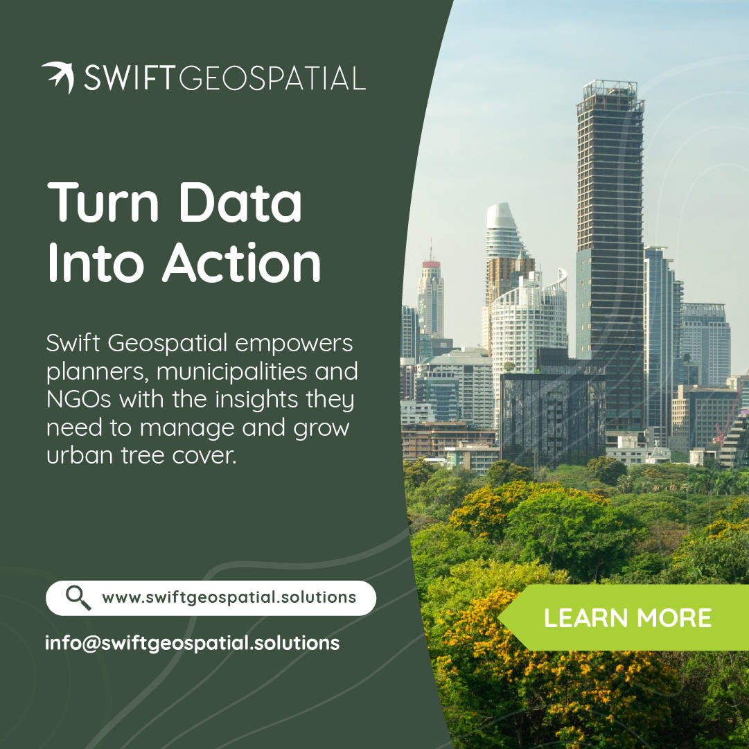
Swift Geospatial is proud to support cities around the world in building more liveable, sustainable and resilient communities. To find out how we can assist your project or city, contact Swift Geospatial.