Clearing the Air: GIS Myths That Still Circulate
GIS is more accessible than ever, yet old misconceptions still shape decisions. This article clears up 15 common GIS myths that affect forestry, mining, agriculture, and compliance projects.
Categories:
Date Posted:
January 22, 2026
GIS sits at a strange crossroads. It is more accessible than ever, yet still widely misunderstood. Satellite imagery updates faster, dashboards look cleaner, and automation does more heavy lifting. And yet, many assumptions about GIS remain stuck in a much earlier era.
Some of these myths date back to the early 2000s, when spatial data was expensive and tightly controlled. Others are newer, fuelled by AI hype or the rise of free online imagery. What they have in common is this, they quietly influence expectations, budgets, timelines, and risk decisions across forestry, mining, agriculture, and environmental compliance.
So let’s clear the air.
Below are fifteen GIS myths that continue to surface in real projects, and what actually sits behind them.

1. “Satellite imagery is always live”
It sounds reasonable, but it is rarely true. Most satellite imagery is captured on scheduled revisit cycles. Availability depends on orbit patterns, tasking priorities, and plain old weather. Cloud cover can delay usable imagery by days, sometimes longer.
In some cases imagery is available within hours. In others, teams may need to wait. Understanding this early helps avoid frustration and unrealistic planning.
2. “High resolution means high accuracy”
A sharp image feels trustworthy. But resolution and accuracy are not the same thing.
Resolution describes how much detail is visible. Accuracy describes how well that image lines up with real world coordinates. An image can look crystal clear and still be offset by several meters. For measurement, compliance, or boundary work, accuracy matters just as much as visual clarity.
3. “GIS is only for mapping”
Maps are the most visible output, so the assumption makes sense. But modern GIS does far more than display features on a screen.
Today’s systems support modeling, automation, probability analysis, forecasting, and scenario testing. The map is often the final layer, not the core function. Much of the real work happens quietly in the background.
4. “Free imagery is as good as commercial data”
Free imagery platforms are powerful and widely useful. They work well for exploration, awareness, and broad assessments.
Operational decisions are different. They often need higher revisit frequency, better positional accuracy, or access to specific spectral bands. That is where commercial imagery still plays a critical role.
5. “GIS automatically fixes data quality problems”
GIS is not a magic filter. Poor inputs still produce poor outputs.
Spatial tools can highlight inconsistencies, but they cannot correct flawed source data on their own. Validation, verification, and quality control remain essential steps, no matter how advanced the software becomes.
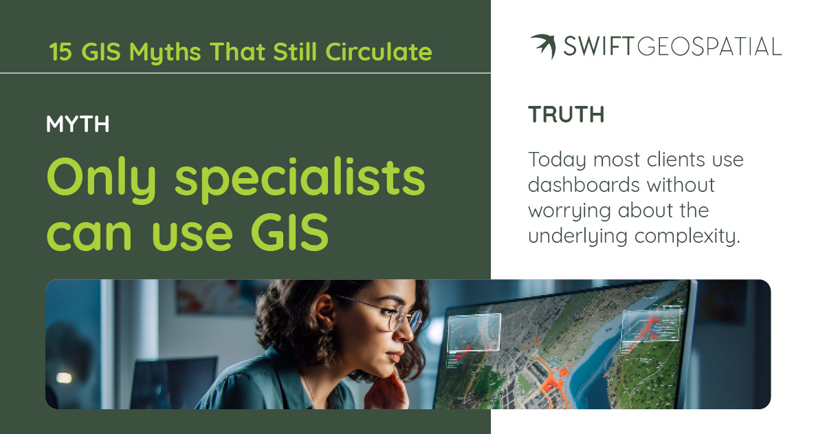
6. “Only specialists can use GIS”
This used to be true. It is much less true now.
Many organisations interact with GIS through dashboards, alerts, and reports without touching the underlying systems. Specialists still design and maintain the workflows, but everyday users often engage with GIS in simple, intuitive ways.

7. “Drones replace satellites”
Drones are excellent at capturing fine detail over small areas. Satellites are unmatched when it comes to consistent, large scale coverage.
They are not competitors. They work best together. One fills in the details. The other provides context and continuity over time.
8. “AI removes the need for analysts”
AI accelerates pattern detection and processing. It does not replace judgment.
Analysts provide context, question results, and understand when outputs do not align with reality on the ground. The strongest outcomes come from pairing automation with human interpretation.
9. “GIS data hardly changes”
Landscapes are far more dynamic than many people realise. Vegetation shifts, infrastructure expands, land use changes, and climate driven impacts appear faster than expected.
Relying on outdated spatial data can quietly undermine decision making. Regular updates matter more than most teams anticipate.

10. “GIS is too expensive for SMEs”
This myth lingers from an earlier era. Subscription models and modular platforms have lowered entry costs significantly.
Many small and medium sized businesses now use GIS as part of daily operations, from compliance tracking to asset monitoring. The barrier is often perception, not price.
11. “More data always leads to better decisions”
It is tempting to collect everything, every layer, every time period, every sensor. But volume alone does not equal clarity.
Too much data can slow analysis, obscure key signals, and increase costs without improving outcomes. Well chosen, relevant datasets almost always outperform sprawling, unfocused collections.
12. “Once a GIS system is set up, it runs itself”
Automation helps, but it does not eliminate oversight.
Workflows need maintenance, assumptions need review, and data sources change over time. Without regular attention, even well designed systems can quietly drift away from reality.

13. “All coordinates line up automatically”
They do not. Coordinate reference systems, projections, and datums still matter, a lot.
Small mismatches can lead to large errors when layers are combined. This is one of the most common sources of confusion, especially when mixing datasets from different providers or regions.
14. “GIS results are always objective”
GIS feels scientific, and often is. But choices still shape outcomes.
How data is classified, filtered, weighted, or visualised introduces human judgment. Two analysts can work from the same data and produce different conclusions. Transparency matters.
15. “GIS insights are only useful at management level”
Strategic planning gets much of the attention, but operational teams often benefit the most.
Field crews, compliance officers, planners, and technicians use GIS outputs to guide daily actions. When insights reach the operational level, small improvements add up quickly.
A More Grounded View of GIS
These myths are unlikely to disappear overnight. But talking about them helps reset expectations and leads to better conversations around scope, timelines, and value.
GIS works best when it is understood realistically, as a practical decision support tool shaped by data quality, context, and clear objectives. Clearing away old assumptions is often the first step toward using it well.