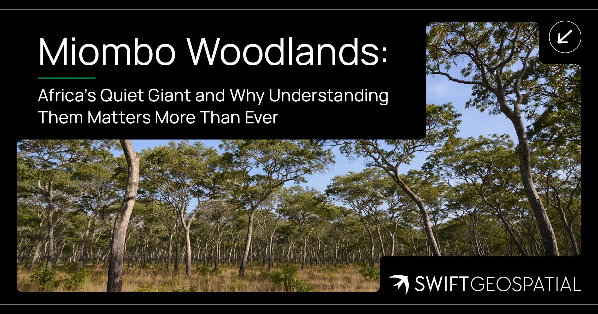
From Satellite to Strategy: How Earth Monitoring Empowers Better Business Decisions
Earth monitoring is transforming how businesses see and understand their world. By combining satellite data from platforms like Planet and Maxar with GIS systems, leaders gain real-time insight into forestry health, agricultural productivity, mining stability, and urban growth. Swift Geospatial turns this spatial intelligence into strategy, helping organisations replace uncertainty with measurable evidence and make smarter, faster decisions that shape the future.
Categories:
Date Posted:
October 23, 2025
How Earth Monitoring Empowers Better Business Decisions
Seeing the Bigger Picture
There’s something fascinating about perspective. From the ground, every decision feels local, a plot of land, a supply chain, a single project site. From above, patterns emerge. You start seeing how one decision ripples into another, how landscapes change, and how subtle shifts in data signal much bigger stories.
That’s exactly where Earth monitoring steps in.
Business leaders today make decisions that move not just companies but communities and entire economies. Yet much of that decision-making still depends on partial, delayed, or fragmented information. Field reports can take weeks. Environmental assessments might reflect last season’s conditions. By the time data arrives, the world has already moved on.
Earth monitoring bridges that gap. Through satellites, drones, and geospatial analytics, it provides a live window into reality, the kind that shows what’s happening right now. It quantifies terrain, vegetation, land use, and infrastructure health with precision that traditional reporting simply can’t match.
It’s not just about seeing from space. It’s about seeing the truth behind every number and every plan.

Turning Data Into Strategic Clarity
Modern boardrooms are filled with dashboards, KPIs, and charts, a constant stream of numbers. But clarity? That’s harder to find.
Data without context is just a confusing noise. When satellite imagery is combined with geographic information systems (GIS), it becomes far more than a visual snapshot. It becomes spatial intelligence, information that connects what’s happening with where and why it’s happening.
Tree monitoring is a perfect example of how this works in practice. Trees tell powerful stories about land, water, and climate, and satellites can read those stories in detail. When mapped and analysed, vegetation data transforms from a green blur on a screen into a living indicator of environmental and economic change.
Imagine this:
- In commercial forestry, a company tracks canopy density and tree growth rates across thousands of hectares without setting foot in the field. Satellite imagery reveals where forest health is declining, helping managers prioritise inspections, prevent disease spread, and plan harvest rotations with minimal disruption. What used to take weeks of manual surveying can now be done in a few hours with data that updates in near real time.
- In agriculture, the same monitoring helps detect windbreak degradation or boundary tree loss around farmlands. These trees play a key role in protecting soil moisture and crop resilience. By identifying early signs of stress or deforestation, farmers can intervene before the next season’s yields are affected. It’s not just about saving trees, it’s about safeguarding food systems.
- In regional planning, local authorities can evaluate how urban expansion impacts nearby tree cover and green corridors. Decision-makers no longer rely on outdated maps or assumptions. Instead, they can visualise exactly where new developments are replacing natural buffers, and plan compensatory planting or zoning strategies that balance growth with ecological integrity.
- In mining and resource operations, continuous monitoring helps detect vegetation loss near tailings or haul roads, often signaling dust pollution or ground instability. With accurate, time-stamped imagery, environmental teams can act before small-scale degradation becomes a compliance issue. Over time, this builds not just operational efficiency, but also environmental accountability.
These aren’t far-off scenarios. They’re practical examples of how Earth observation turns raw imagery into business intelligence. Tree cover data, when layered with soil, water, or land-use datasets, provides an immediate sense of place and impact, the kind of context that makes decision-making more confident and more responsible.
Whether the goal is to manage assets, restore ecosystems, or plan sustainable growth, tree monitoring demonstrates how spatial data helps turn uncertainty into clarity, and strategy into measurable progress.

The Boardroom Value of Ground Truth
Financial reports can tell you how the business performed. Earth monitoring tells you why.
It’s the difference between looking at the score after the game and understanding how the game was played. Financial data reveals outcomes, but satellite data reveals the conditions that shaped those outcomes, the physical reality behind every number in the spreadsheet.
Executives make billion-dollar decisions based on the information they have at hand. The problem is that information often arrives too late or too filtered to show what’s really happening. By the time a quarterly report is reviewed, environmental or operational conditions on the ground may have already shifted. Tree loss, soil erosion, or encroaching activity near a project site could go unnoticed until the impacts start costing money.
When Earth monitoring enters the picture, that delay disappears. Satellite-based intelligence updates continuously, showing change as it unfolds. Leaders can overlay these visual insights with their financial or production data and immediately see correlations, such as how reduced canopy health aligns with declining water availability, or how vegetation encroachment hints at future access issues.
This kind of timeliness does more than support better management; it transforms governance itself. Boards can move from reactive to preventative oversight. Instead of responding to problems after they appear in a report, they can act on the early indicators that something is shifting.
Take a mining operation, for example. A quarterly safety report might show no incidents, yet near-real-time Earth observation could reveal gradual land subsidence along haul roads. With that information, executives can authorise maintenance before any cracks appear. In agriculture, a procurement team might see stable production numbers while satellite imagery quietly shows tree cover thinning around irrigation zones, a warning that soil moisture and long-term productivity are at risk.
These examples illustrate a bigger truth: decisions are only as good as the data that informs them. When the data is current, visual, and verifiable, leaders gain something more powerful than information. They gain confidence.
That confidence reshapes how boards think about sustainability and compliance too. For those responsible for ESG reporting, up-to-date monitoring replaces fragmented field notes with a continuous, objective record that can be trusted across teams and territories. It ensures transparency not because it is mandated, but because it is measurable.
With visual, time-stamped proof, discussions shift from speculation to substance. Stakeholders do not need to rely on interpretations or assumptions when they can clearly see what is happening on the ground. Whether it is tracking forest regrowth, verifying rehabilitation progress, or ensuring no encroachment near protected zones, Earth monitoring gives executives evidence they can stand behind.
In a sense, it restores integrity to the decision-making process. It connects the boardroom directly to the landscapes their businesses depend on. And when that connection is live, measurable, and trusted, decisions become faster, smarter, and far less risky.
Better information does not just improve choices; it changes outcomes.
It is a clearer kind of truth, one that stands up to scrutiny and strengthens accountability from the ground up.

Seeing Change Before It Happens
Every organisation wants to stay ahead of change. Yet forecasting what comes next based on gut feeling or outdated models often leads to missed opportunities and unnecessary risk. Predictive Earth monitoring changes that by turning long-term observation into foresight.
When historical satellite imagery is compared with current data, patterns begin to tell their story. A slight shift in tree canopy color might signal early disease stress in a plantation. A gradual thinning of vegetation could point to changing rainfall patterns that threaten next season’s harvest. Even the faint trace of new clearings around city edges might indicate upcoming development pressure on green spaces.
Each of these details might seem small on its own, but together they reveal powerful trends. They help decision-makers see the direction of change before it becomes visible on the ground.
In agriculture, this means farmers can detect soil moisture loss weeks before it affects crop growth. They can respond by adjusting irrigation schedules or introducing cover crops that protect against further decline. A sugarcane producer, for instance, could identify where canopy density is dropping and target that area with soil rehabilitation rather than waiting for yield loss to confirm the problem.
In forestry, monitoring tree health over time helps operators anticipate disease outbreaks, illegal felling, or fire risk. Early intervention can preserve both timber value and environmental stability. When canopy loss or discoloration is spotted in time, resources can be directed toward those areas for closer inspection and recovery.
Urban planners also benefit from this predictive view. By comparing several years of land-use imagery, they can track how cities expand, where vegetation buffers are shrinking, and how infrastructure projects affect surrounding ecosystems. This helps guide zoning decisions and tree-planting programs that maintain green corridors and reduce urban heat.
The strength of predictive Earth monitoring lies in its consistency. It does not rely on forecasts that assume future behavior; it relies on visible, measurable change that has already begun. The technology runs quietly in the background, continuously watching for the small shifts that precede larger transformations.
When businesses and governments use this information well, they move from reacting to events to preparing for them. They can test scenarios, model potential impacts, and make decisions grounded in actual evidence rather than projections or intuition.
It functions almost like an early-warning system for the planet, steady and objective, giving those who pay attention the chance to act while there is still time to make a difference.


Building Intelligence Across Industries
One of the greatest strengths of Earth monitoring is its ability to serve many industries at once. Wherever decisions depend on location, satellite imagery brings clarity, accuracy, and confidence. It feeds directly into Geographic Information Systems (GIS), giving organisations the spatial foundation they need to make sense of complex data.
A GIS system is essentially a digital mirror of the real world. It stores information about terrain, vegetation, infrastructure, and water in layers that can be viewed, analysed, and updated. Satellite imagery provides the most accurate and up-to-date base for this system. Without it, the “map” that decision-makers rely on is incomplete.
When new satellite data is captured, it refreshes these layers with real conditions on the ground. Land boundaries, tree cover, or construction footprints can be validated automatically. This makes GIS not just a static tool for mapping but a living database that reflects change as it happens.
Resource-Based Operations
In resource-heavy industries such as energy, mining, and water management, understanding the physical environment is just as important as tracking financial performance. Satellite data allows GIS specialists to map operations precisely, monitor land use, and detect small but significant changes over time.
For instance, by layering satellite imagery within a GIS platform, a mining company can visualise its tailings storage areas, surrounding vegetation, and watercourses in a single interface. Subtle shifts in surface elevation can be tracked, helping teams identify early signs of ground deformation. This level of monitoring improves both safety and compliance, while reducing the need for frequent site inspections.
The result is a clear, continuous view of operational health, supported by measurable evidence rather than assumptions.
Agriculture and Food Systems
In agriculture, the connection between satellite imagery and GIS is especially powerful. Farms and agricultural zones are vast, and conditions can vary dramatically from one field to the next. By combining multispectral imagery with GIS layers, analysts can identify soil moisture variations, vegetation stress, and irrigation performance at scale.
For example, farmers and agronomists can overlay crop yield maps with satellite-derived vegetation indices to pinpoint where trees or crops are underperforming. This allows targeted interventions such as adjusting irrigation or applying nutrients only where needed. It saves water, reduces waste, and protects the long-term health of the land.
These same datasets help food distributors and insurers too. By using GIS platforms that integrate satellite monitoring, they can forecast supply chain fluctuations, assess drought risks, and make better financial decisions about coverage and investment.
Urban and Infrastructure Development
In cities, growth is constant and often unpredictable. Satellite imagery helps planners and developers track expansion accurately, providing fresh inputs for GIS systems that model land use and infrastructure change.
Urban planners can compare multi-year imagery to see where green spaces are shrinking or where informal settlements are expanding. This data feeds directly into zoning and environmental management layers, helping municipalities balance growth with sustainability. Engineers can also use the same information to validate construction progress, monitor encroachment near protected areas, or detect heat buildup in densely built regions.
What makes this approach so powerful is its consistency. Satellite imagery updates the GIS database regularly, ensuring decisions are based on the current state of the environment, not outdated maps. It transforms city planning from a reactive process into a dynamic, evidence-based practice.
A Connected View of the Planet
Across all these sectors, the real advantage lies in integration. Satellite imagery keeps GIS systems alive with accurate, near-real-time data. It turns static maps into interactive platforms for analysis, prediction, and action.
Whether it’s mapping deforestation, tracking urban expansion, or monitoring agricultural resilience, Earth monitoring ensures that the data behind every decision is both verifiable and current. It gives industries a connected view of the planet, one where the patterns of change can be seen, measured, and understood.
In the end, it’s not just about having more data. It’s about having better data, organised spatially and updated continuously, so every choice made (from the boardroom to the field) is informed by the truth on the ground.

Making Earth Monitoring Actionable
Having access to satellite data is one thing. Turning that data into something useful is another. The real value of Earth monitoring lies not in the pixels or the images themselves, but in how the information is integrated, interpreted, and applied.
Many organisations collect enormous volumes of spatial data yet still struggle to make it part of their daily decision-making. The ones that succeed treat Earth monitoring as a continuous feedback loop rather than a one-off exercise. They understand that satellite data must flow into existing systems, shape analysis, and ultimately drive real outcomes on the ground.
This process usually follows three essential steps that build on one another.
Integration
The first step is bringing spatial data into familiar business formats. Decision-makers do not need to open a map viewer every time they want to understand performance. Instead, satellite data can be integrated directly into executive dashboards, ESG reporting tools, or asset management systems that leaders already use.
For example, a forestry company might embed canopy density metrics into its operational dashboard, allowing managers to see forest health trends alongside production targets. A municipality might integrate vegetation loss indicators into its sustainability reports, ensuring that urban development is evaluated against real, current data rather than old surveys.
This kind of integration turns complex geospatial information into something usable. It bridges the gap between technical analysis and practical decision-making.
Interpretation
Once integrated, the next challenge is understanding what the data actually means. Satellite imagery is powerful, but without interpretation, it is just a collection of pixels. This is where GIS specialists, environmental analysts, and data scientists play a crucial role.
They translate raw spatial information into clear insights that relate to finance, planning, and operations. For instance, spectral analysis can show declining tree health in a plantation, but analysts can link that to water stress or disease spread, explaining how it might affect future yields. In mining, they can identify slight changes in surface elevation and interpret them as potential early signs of ground movement.
Interpretation gives context to the data, helping executives connect environmental change to business performance.
Implementation
The final step is embedding these insights into regular business cycles so that they actually influence outcomes. This means including spatial intelligence in monthly reviews, annual planning, and long-term strategy sessions.
A water utility might use satellite data every quarter to reassess reservoir conditions before planning infrastructure upgrades. An agricultural firm could incorporate vegetation indices into its seasonal planting models to decide where to invest resources next. By aligning operational decisions with continuously updated spatial information, the organisation becomes more adaptive and more resilient.
Implementation turns knowledge into action. It ensures that data does not stay locked in reports but informs real-world choices.
From Instinct to Evidence
When this cycle works smoothly, Earth monitoring becomes more than a technical capability. It becomes part of the organisation’s culture of decision-making. Leaders stop guessing and start verifying. They can justify actions with measurable evidence rather than relying on assumptions or outdated field data.
This shift from instinct-based management to evidence-based leadership builds confidence across every level of the organisation. Field teams trust that their work is supported by accurate insights, executives trust that investments are informed by reliable data, and stakeholders trust that reports are grounded in reality.
Earth monitoring only reaches its full potential when it moves beyond data collection into decision integration. When that happens, organisations gain not just better information, but a new way of seeing their operations — one rooted in clarity, accountability, and measurable progress.

The Competitive Edge of Spatial Intelligence
Some organisations move faster, plan better, and adapt sooner than others. It is not luck. It is clarity. Businesses that embrace Earth monitoring early often find themselves quietly outperforming their peers because they see what others miss.
When leadership teams have access to spatial intelligence, they can measure not only what is happening inside their operations but also how their surroundings influence those outcomes. They can see relationships between land, water, vegetation, and infrastructure that ordinary data cannot reveal. This allows them to make decisions that are informed, precise, and future-focused.
One of the most powerful advantages of spatial intelligence is the ability to measure risk in both physical and financial terms. A mining firm can quantify how shifting terrain might affect haul routes or nearby water systems, turning environmental uncertainty into measurable risk. A forestry company can calculate how canopy health trends impact long-term yield projections and asset value. In both cases, the organisation gains a more complete understanding of its exposure, allowing it to act before losses occur.
Spatial intelligence also strengthens transparency. Sustainability claims no longer need to rely on text-heavy reports or manual audits. Instead, executives can point to visual proof. Time-stamped satellite imagery can verify that rehabilitation zones are progressing, that new planting programs are succeeding, or that operations remain within permitted boundaries. Investors and regulators can trust what they see, not just what they are told.
The same principle applies to operational efficiency. Spatial data helps uncover inefficiencies that standard performance metrics often overlook. It might reveal underused land assets sitting idle on a company’s balance sheet, or infrastructure slowly deteriorating at the edge of a property. Once visible, these issues become manageable. Managers can make adjustments that save both time and money while maintaining compliance and environmental responsibility.
At its core, spatial intelligence is about thinking geographically. It helps decision-makers connect dots between location and outcome, between logistics and regulation, and between environmental change and business growth. Every asset, every activity, and every decision is linked to a place on the map. Understanding those connections allows organisations to plan smarter and respond faster when conditions shift.
This geographic perspective does more than reduce risk. It reshapes what responsible leadership looks like. It builds a culture where decisions are rooted in evidence, where sustainability is measurable, and where strategic vision is supported by continuous observation of the real world.
In an era where uncertainty has become the norm, spatial intelligence gives companies a steady advantage. It enables them to see early, act decisively, and stay aligned with both economic and environmental priorities.
When business leaders can view their operations within the broader landscape, they do more than compete effectively. They lead with insight and integrity, confident that their choices are grounded in truth and supported by the data beneath their feet.

Transform Your Strategy
Every organisation operates within an environment that never stands still. Weather patterns shift, land use changes, populations grow, and markets evolve. Policies are rewritten, supply chains adjust, and environmental pressures increase. The companies that remain resilient are not the ones that simply react, but the ones that observe, interpret, and prepare.
Earth monitoring turns that mindset into a structured practice. It provides measurable, verifiable evidence of what is happening on the ground, offering leaders the clarity to act with confidence rather than assumption.
Modern satellite constellations make this possible at a scale that was unimaginable a decade ago. Planet’s Dove satellites, for example, capture imagery of the entire Earth every day, producing a living record of change. These small but powerful satellites deliver continuous data on vegetation health, infrastructure expansion, and environmental impact. When combined with the sub-meter detail available from Maxar’s high-resolution satellites, organisations can monitor both the broad landscape and the finer details that matter to their operations.
This dual perspective transforms strategy. A forestry company can track canopy health across entire regions while also inspecting specific zones for storm damage or disease. An agricultural investor can monitor thousands of hectares of farmland daily, ensuring productivity aligns with sustainability goals. A mining operator can oversee remote sites, validate rehabilitation progress, and detect encroachment with pinpoint accuracy.
When satellite intelligence is layered within a geographic information system, it forms a complete and living picture of reality. Leaders can see trends forming in real time, measure the physical impact of their actions, and test the long-term implications of their plans. This visibility turns uncertainty into actionable insight.
In the boardroom, that kind of evidence changes everything. A clear, up-to-date view of operations removes hesitation and supports decisions that are both strategic and responsible. When leadership teams understand the true state of their assets and the environments they depend on, they can plan with precision and invest with confidence.
Swift Geospatial stands exactly at that intersection where observation becomes action. By transforming raw data from platforms like Planet and Maxar into clear, contextual intelligence, it gives organisations the power to see what others overlook. It equips leaders to measure what truly matters and to act while opportunities are still within reach.
With the right information, timing, and vision, satellite data does more than map the world. It helps reshape the way business sees itself within it.