2025 in Review and a Glimpse of What 2026 Holds for Swift Geospatial
2025 brought major shifts to the geospatial world, from new satellite constellations to sharper analytics that changed how organisations manage land, assets, and environmental risk. At Swift Geospatial, it was a year of growth, clearer purpose, and stronger solutions for clients who depend on spatial intelligence. As we move into 2026, we are expanding automation, launching new dashboards, and strengthening support for EUDR and operational monitoring. This year end review reflects on the progress made and offers a look at what’s coming next.
Categories:
Date Posted:
December 3, 2025
Every December seems to arrive a little faster than the one before. Maybe it is the rush of wrapping up projects or the long list of client deadlines that stretch right to the last week. Or maybe it is just the way the geospatial world moves now, with near daily advancements in imagery, analytics, automation, and regulatory shifts that keep every GIS team on its toes.
Either way, 2025 gave us a lot to look back on. It was a year where the geospatial industry pushed forward with new constellations, sharper sensors, and better analytical pipelines. And for us at Swift Geospatial, it became a year where our purpose felt clearer than ever. Offering spatial intelligence that people actually understand and use in the real world. Not fluffy visuals. Not complicated data dumps. Real insight that helps real operations.
Let me take you through the highlights, some behind the scenes thoughts, and what you can expect from us in 2026.

A Big Year for Satellites and Spatial Intelligence
If there is one phrase that sums up 2025, it is “more eyes in the sky.” Not in the sci fi sense, but in the very practical sense that we now have faster, more diverse, and more powerful satellite systems feeding global datasets.
Planet officially expanded its constellation with Pelican and Tanager, two systems that have already started reshaping environmental and emissions monitoring. Tanager in particular shook things up. For the first time, commercially available methane and CO2 plume imagery hit the market with revisit cycles that make operational monitoring far more realistic. What used to rely on occasional airborne surveys now arrives as regular taskable data. You know what? Seeing clients immediately plug it into leak detection workflows felt like a real milestone.
Vantor, formerly MAXAR, closed out the commissioning of the WorldView Legion satellites. With the constellation fully operational from February, an enormous high resolution archive has already started building up. For GIS teams working with urban growth, infrastructure mapping, asset assessment, or engineering feasibility studies, the consistency of that archive matters.
And while these industry milestones were happening, we saw something interesting among our own clients. They started asking deeper questions about temporal change, environmental baselines, and automated systems that can run with minimal oversight during holiday periods or staff shortages. That shift told us a lot about where GIS is heading. Toward systems that feel less like “tools” and more like operational companions.

How Satellite Imagery Quietly Keeps Holiday Operations Running
People outside the geospatial field often imagine December as a sleepy downtime period. Schools are closing, businesses run skeleton crews, and inboxes go quiet. Yet anyone involved in logistics, retail, agriculture, forestry, facilities management, coastal oversight, or emergency readiness knows that this month can be just as demanding as the rest of the year, if not more.
Satellite imagery becomes a kind of silent support system behind many of these operations.
Retail and logistics teams lean heavily on up to date satellite views to understand shifts in traffic flow, bottlenecks around distribution hubs, and the way seasonal demand changes movement patterns. When thousands of parcels compete for tight delivery windows, even minor route adjustments matter.
Forestry and agriculture clients rely on clear summer imagery to assess stress patterns, droplet irrigation performance, canopy closure, and harvest readiness. It is a season when heat spikes can trigger sudden issues, and having wide area coverage helps crews respond faster.
Then there is the coastal side of things. Holiday crowds bring pressure to dune systems, wetlands, and beachfront infrastructure. Imagery collected during this period gives municipalities and conservation teams a baseline for erosion, footpath spread, and temporary human impacts.
Because satellites keep collecting whether people are on holiday or not, they offer a reliable level of situational awareness during a period when on the ground staff may be rotating, unavailable, or stretched thin. Our own operations team keeps watch throughout December so clients never feel stuck waiting until mid January for updates.

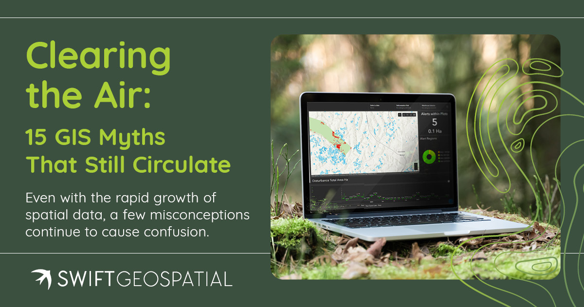
Clearing the Air: 10 GIS Myths That Still Circulate
Even with the rapid growth of spatial data, a few misconceptions continue to cause confusion. Some myths have been around since the early 2000s, while others popped up recently with the rise of AI or free online imagery. Let’s clear up a few of the most common ones we hear.
1 – “Satellite imagery is always live.”
It is not. Availability depends on revisit intervals, tasking priorities, and weather. Sometimes it becomes available within hours. Sometimes it might take days.
2 – “High resolution means high accuracy.”
A crisp image does not always mean its location reference is perfect. Resolution shows detail. Accuracy shows trustworthiness.
3 – “GIS is only for mapping.”
Modern GIS handles modeling, automation, probability, forecasting, and scenario testing. The map is only the surface layer.
4 – “Free imagery is as good as commercial data.”
Free platforms perform well for broad use cases, but operational decisions usually require better clarity, frequency, or spectral depth.
5 – “GIS automatically fixes data quality problems.”
Garbage data produces garbage results. Quality control still matters.
6 – “Only specialists can use GIS.”
Today most clients use dashboards without worrying about the underlying complexity.
7 – “Drones replace satellites.”
They do not. They complement them. Drones excel at detail. Satellites excel at big picture coverage.
8 – “AI removes the need for analysts.”
AI helps. Analysts interpret. Both are needed.
9 – “GIS data hardly changes.”
Land use, infrastructure, vegetation, and climate driven changes evolve quickly. Many people underestimate how dynamic landscapes really are.
10 – “GIS is too expensive for SMEs.”
Subscription models have lowered the barrier significantly. Many small firms use GIS operationally now.
These myths are not going away overnight, but conversations around them help promote better decision making and more realistic expectations.

What Swift Geospatial Has Planned for 2026
We are entering the new year with a focused roadmap that reflects what clients told us throughout 2025. People want clarity. They want automation where it makes sense. And they want tools that do not require a GIS degree to understand.
Here is what you can look forward to in 2026.
Expanded Monitoring Services
We are pushing more automated workflows into harvest monitoring, change detection, and environmental compliance. The goal is to give clients quick insights that require fewer manual steps, especially for operations covering large, remote, or fragmented areas.
Stronger EUDR Support
SMEs in particular face tight deadlines and documentation challenges. We are rolling out expanded validation tools, land use assessments, and geolocation pipelines that simplify everything from traceability to deforestation checks.
New Dashboards and Reporting Tools
You will see the rollout of our SWIFTFOREST, SWIFTFARM, SWIFTMINE, and SWIFTDETECT platforms. These systems bring cleaner interfaces, faster load times, and easier navigation for people who need actionable information without climbing steep learning curves.
Broader Imagery Access
We are integrating more high resolution and high revisit satellites so clients have more consistent coverage throughout the year, regardless of season or region.
Enhanced Client Support
Training, onboarding, and step by step guides are being expanded. Many teams rely on rotating staff, and we want new users to feel comfortable the moment they log in.
We are excited about these improvements because they come from real conversations and real needs shared by clients across Africa and beyond.

A Warm Thank You as the Year Comes to a Close
As the year winds down, we want to thank everyone who partnered with us, asked us hard questions, tested our systems, and trusted our team through 2025. Progress in geospatial intelligence rarely happens alone. It happens through collaboration, curiosity, and a shared desire to understand the world better.
Whether you are shutting down for a well deserved break or managing non stop operations through the summer season, we hope you find a moment to rest and reflect. This time of year has a way of reminding us why the work matters and who we do it for.
From all of us at Swift Geospatial, we wish you a safe, peaceful, and joyful festive season, and we look forward to achieving even more with you in 2026.