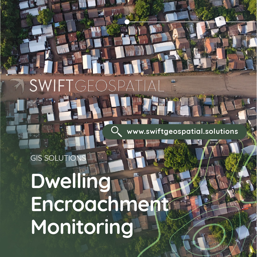
How to Manage Dwelling Encroachment
Learn how to detect and prevent unauthorised settlement growth in South Africa using GIS-based monitoring. Discover how baseline mapping, automated change detection, and satellite imagery help protect infrastructure, sensitive land, and communities.
Categories:
Date Posted:
August 26, 2025
Planning ahead
Dwelling patterns are never static and as certain locations become more desirable to move towards due to nearby job opportunities, upgraded infrastructure, or attractive landscapes, new residential structures begin to appear across the board. This type of growth is a sign of progress in the economy and the city itself. The problem we look to address arises when dwellings start appearing in areas where construction is not authorised, such as servitudes, environmentally protected zones, or land surrounding critical infrastructure.
In South Africa, where land scarcity, unemployment, and delays in service delivery create intense pressure, informal settlement in unsuitable or unsafe areas has become a significant challenge.

Encroachment Challenges in South Africa
The spread of unauthorised settlements is not new in South Africa, but it has accelerated in recent years. This growth is fuelled by rapid urbanisation, ongoing housing shortages, deep socio-economic inequality, and political pressure to address land redistribution. The result is a surge in informal dwellings built on land not zoned for housing.
The problem is most visible in peri-urban zones, which lie between dense city areas and rural land. These areas often have limited oversight and underutilised or vacant plots, making them attractive for informal development. Unfortunately, the consequences are more than just zoning violations.
Encroachment onto critical infrastructure corridors can create severe safety, environmental, and operational risks, including:
- Railway servitudes where informal structures sit dangerously close to tracks, putting residents at risk and blocking maintenance teams.
- Power line corridors where electrocution hazards and compromised grid reliability become real threats.
- Pipeline routes carrying gas or fuel, where even a small leak could cause disaster.
- Mining buffer zones in provinces like Mpumalanga, Limpopo, and North West, where structures are built illegally on rehabilitated mining land, undermining closure protocols and safety measures.
- Floodplains and wetlands where construction damages ecosystems and raises the risk of flooding disasters.
In many provinces, municipalities and utilities are struggling to keep up. Traditional methods like manual site inspections or waiting for public complaints are too slow. By the time a new settlement is formally detected, it is often already well established, making intervention costly and politically sensitive.
Adding to the complexity, some invasions are organised, with dwellings appearing in large numbers almost overnight, complete with building materials and even informal services. Illegal land sales by individuals or groups claiming authority are common, creating tangled disputes between landowners, community leaders, and traditional councils.
The impact is not just physical. Once informal dwellings are established, risks often include:
- Cable theft targeting nearby infrastructure
- Vandalism or sabotage of substations, valves, and gates
- Illegal power connections that threaten both residents and technicians
- Blocked access for maintenance teams during emergencies
These challenges have led many stakeholders to adopt modern geospatial monitoring tools. High-resolution satellite imagery allows for continuous, wide-area monitoring, even in rural and remote locations. This gives early warning of encroachment and provides reliable evidence to guide action before settlements become entrenched.

A GIS-Based Approach to Dwelling Monitoring
Across Africa, settlement growth often happens quickly and without formal approval, particularly in regions where land tenure is unclear or enforcement capacity is stretched thin. A GIS-based monitoring system offers a way to see and understand this change in real time, giving land managers the opportunity to act before a temporary shelter turns into a fully established community.
Swift Geospatial’s approach combines high-resolution satellite imagery with advanced geospatial analytics to provide a clear, up-to-date view of what is happening on the ground. This is particularly important in situations where manual inspection is slow, costly, or even unsafe. In many rural or high-risk areas, physical access is limited by poor road infrastructure, seasonal weather conditions, or security concerns, making a remotely accessible monitoring system invaluable.
The technology can be applied to a wide range of contexts. In one example, a remote mining buffer zone in southern Africa might see the gradual arrival of temporary shacks along its perimeter. Without regular monitoring, these dwellings can quickly multiply, leading to disputes over land rights and safety concerns related to blasting or heavy vehicle operations. In another case, a pipeline corridor in East Africa may be exposed to informal farming and settlement, with structures creeping closer to underground fuel lines over time. These situations pose both operational risks and serious public safety hazards.
Wetlands and floodplains in West and Central Africa also face encroachment pressure, often from communities seeking fertile land for farming or from settlements that expand during dry seasons when the land appears safe. Without intervention, this type of development increases disaster risk during seasonal rains and undermines vital ecosystem services.
The same monitoring approach is equally relevant for power corridors that span multiple countries. Informal dwellings, market stalls, or small-scale businesses can spring up under high-voltage lines, creating both electrocution hazards and maintenance access issues. By continuously tracking these corridors with satellite imagery, authorities can see exactly where change is occurring and how fast it is progressing.
Because the system is scalable, it can be applied to anything from a single site to thousands of kilometres of infrastructure. Automated change detection tools highlight even small variations in land use, while interactive dashboards allow users to filter alerts by severity, proximity to assets, or rate of growth. This means resources can be prioritised effectively, focusing first on areas where encroachment is fastest or poses the greatest operational, environmental, or safety risk.
By integrating local data such as land ownership boundaries, environmental buffers, and zoning restrictions, the GIS platform ensures that alerts are not just about spotting change, but about identifying which changes matter most. This targeted insight helps avoid unnecessary interventions and directs efforts where they will have the greatest impact.
In regions where legal processes for removal or relocation are complex and community relations are sensitive, early detection is not simply a technical advantage—it can be the difference between resolving a situation through negotiation or facing a protracted, expensive dispute. Through continuous satellite monitoring and geospatial intelligence, Swift Geospatial’s approach gives stakeholders the ability to protect assets, uphold safety standards, and support responsible land management long before encroachment reaches a critical stage.


Key Components of the Solution
An effective encroachment monitoring system is built on several interlinked components that together create a reliable, evidence-based decision-making framework. Each step strengthens the ability to identify unauthorised settlement early, understand the scale of change, and act before risks escalate.
Baseline mapping
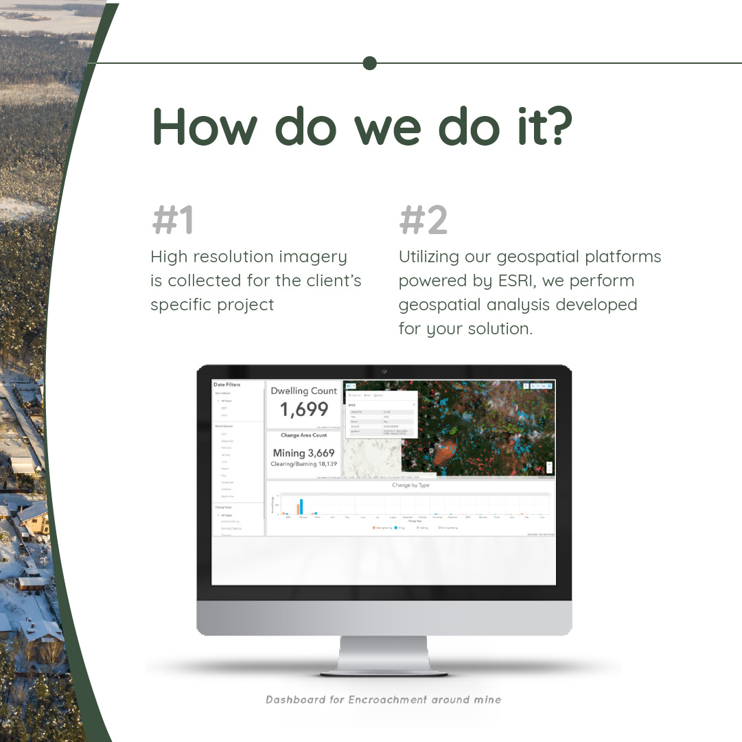
The process begins with establishing an accurate baseline. Using high-resolution satellite imagery, typically in the 30–50 cm range, we create a detailed map of all existing structures within and around the zones of interest. This baseline serves two purposes. First, it provides a precise benchmark against which all future changes can be measured, eliminating the uncertainty that often arises in disputes about when a settlement began. Second, it can act as admissible evidence in legal or regulatory contexts, documenting the original condition of the land before any encroachment occurred. In areas such as mining buffer zones, wetlands, or utility corridors, this initial dataset is critical for both operational planning and compliance.
Automated change detection
Once the baseline is in place, updated imagery is collected on a fixed schedule—daily, weekly, or quarterly depending on how sensitive or exposed the site is. These fresh images are analysed using change detection algorithms within ESRI ArcGIS. The system scans for alterations in land cover, density of structures, or visible signs of new construction. For example, in a pipeline servitude, even a few small roof structures appearing near the route would trigger an alert. This automation removes the delays of manual inspections and ensures that stakeholders are notified as soon as meaningful change occurs.
Interactive dashboards
Monitoring data is delivered through an ESRI-based dashboard, giving stakeholders a real-time, interactive view of the monitored area. Multiple layers of spatial information can be displayed together, including cadastral boundaries, property ownership details, servitude lines, infrastructure corridors, and environmental risk zones such as floodplains. Time-stamped alerts show exactly when a change was first detected, enabling quick prioritisation of responses. For instance, if an alert shows dwellings expanding toward a high-voltage power corridor, that can be flagged as an urgent safety concern requiring immediate attention.
Mobile field verification
Digital monitoring alone is not enough. Once potential encroachment is flagged, field teams can be dispatched using ArcGIS Field Maps on mobile devices. These teams verify the flagged structures, capture photographs, record GPS coordinates, and gather relevant context on-site. They may also engage with local community representatives to better understand the situation. The information collected feeds directly back into the monitoring system, improving detection accuracy over time and ensuring that interventions are informed by ground realities rather than just imagery.
Additional benefits that this integrated GIS approach offers a range of operational advantages:
- It provides remote coverage of locations that are either inaccessible due to poor road infrastructure or unsafe because of environmental or security risks.
- Timestamped imagery offers strong legal defensibility, as it creates a verifiable history of when and where changes occurred.
- Alert thresholds can be customised to match the operational priorities of each stakeholder—whether that is the appearance of a single dwelling in a sensitive area or a cluster of structures near a major asset.
- The system scales easily, from small, high-value sites like substations or pumping stations to infrastructure corridors stretching across multiple provinces.
By combining these components, the solution moves encroachment management from a reactive, complaint-driven process to a proactive, intelligence-led system that saves time, reduces conflict, and protects asset value over the long term.

Early Detection Reduces Legal and Financial Risk
In many African countries, including South Africa, once informal dwellings are established, removing or relocating them is not a simple enforcement exercise. The process is legally complex and can stretch over months or even years. It often requires court orders, structured community consultations, and strict adherence to constitutional or statutory protections around the right to housing. By the time this process begins, costs have already escalated and options for resolution have narrowed significantly.
Early detection changes the dynamic entirely. When encroachment is spotted at the earliest stages, there is more room to explore practical and less confrontational solutions. In some cases, it may be possible to redirect settlement activity toward safer or legally approved areas before infrastructure or environmental assets are compromised. In others, negotiations with community representatives may lead to alternative land allocation or even formalising occupation through controlled, compliant development. These approaches can prevent long-running disputes while preserving relationships between landowners, authorities, and affected communities.
Delays in detection, however, can lead to far more serious outcomes:
- Infrastructure damage and blocked access such as a pipeline inspection team being unable to reach a valve station, or a rail maintenance crew finding their route obstructed by dwellings.
- Health and safety hazards in high-risk zones, including floodplains, high-voltage corridors, or areas prone to ground subsidence.
- Service delays for utilities and mines where operational schedules depend on uninterrupted site access.
- High legal costs related to eviction proceedings, compliance with environmental regulations, or litigation from affected parties.
- Increased community tension when late-stage interventions are perceived as sudden, unfair, or poorly communicated.
A GIS-based monitoring system with near real-time alerts and clear, timestamped imagery enables stakeholders to intervene before risks multiply. The visual evidence supports informed decision-making, while the speed of detection allows for a response that balances operational needs with social and legal considerations. This proactive approach not only reduces financial exposure but also strengthens credibility and trust with all parties involved.
Ask ChatGPT

Supporting Stakeholders and Regional Planning
Encroachment monitoring via GIS methods delivers the greatest value when it is not treated as a standalone tool, but rather integrated into wider land use planning and governance frameworks. By feeding accurate, up-to-date spatial data into municipal development plans, sector-specific land management strategies, and national infrastructure programmes, decision-makers can respond to land pressures in a way that is both timely and well-coordinated.
The platform supports a diverse range of stakeholders:
- Municipalities can use monitoring data to anticipate where informal growth is occurring and align service delivery accordingly. This is particularly important for housing rollouts, road upgrades, or sanitation projects, where misaligned timing can lead to service backlogs or public dissatisfaction.
- Mining companies benefit from early alerts about activity near buffer zones, tailings storage facilities, or rehabilitated land, allowing them to maintain environmental compliance and protect the safety of nearby communities.
- Utilities and state-owned enterprises can ensure uninterrupted access to pipelines, substations, power lines, and rail corridors, minimising the risk of operational shutdowns caused by blocked routes or damaged infrastructure.
- Traditional authorities can track and manage communal land more transparently, reducing disputes over allocation and helping to prevent illegal sales of plots.
- Provincial and national planners gain insight into real settlement patterns, enabling infrastructure investments and economic development projects to be based on verified, current land use data rather than outdated surveys or projections.
Time-stamped imagery and growth trend analysis give planners and asset managers a clear picture of how quickly a settlement is expanding, in which direction it is moving, and which boundaries or environmental features it is approaching. This level of visibility is especially valuable in areas with overlapping or contested land rights, where evidence-based engagement can help build trust among all parties.
By making encroachment data part of the broader planning process, stakeholders can shift from reactive enforcement to proactive, collaborative land management. This supports more efficient infrastructure rollout, reduces conflict, and encourages sustainable, well-planned growth across regions under development pressure.

Protecting Land and Infrastructure Through Early Detection
As South Africa’s cities and towns continue to expand, the pressure on available land and essential infrastructure is only increasing. Encroachment into servitudes, high-risk areas, and environmentally sensitive zones is no longer an occasional problem, it is an ongoing challenge with significant operational, safety, and legal implications. Once informal development takes root, the process of managing it becomes far more complex, often involving drawn-out legal proceedings, service disruptions, and elevated community tensions. The most effective way to avoid these long-term consequences is to detect and address unauthorised development at the earliest possible stage.
Swift Geospatial’s GIS-based monitoring solution brings together high-frequency satellite imagery and advanced geospatial analytics to give municipalities, utilities, mining operators, and private landowners a precise, up-to-date view of where potential threats are emerging. This clarity allows stakeholders to move from reactive crisis management to proactive, planned intervention, protecting assets, ensuring compliance with regulatory requirements, and reducing safety risks before they escalate.
With data sourced from leading satellite providers such as Planet and Maxar, and fully integrated using ESRI technology, our system delivers actionable intelligence in near real time. Whether the focus is a single high-value servitude, a vast multi-province pipeline corridor, or an ecologically sensitive wetland, we provide the insight needed to act with confidence and precision. This ensures that development is managed responsibly, infrastructure remains secure, and long-term sustainability is supported.