Swift News

Deforestation-Free Summit 2025

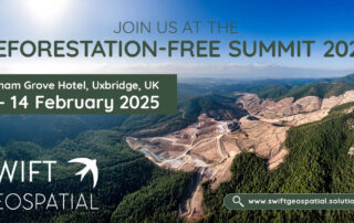
Swift Geospatial is attending the Deforestation-Free Summit 2025 on February 13–14 in Uxbridge, UK, where Michael Breetzke will present a case study on a successful deforestation monitoring project. Learn how GIS and satellite imagery support EUDR compliance and proactive deforestation risk management. Visit our booth to explore how our cutting-edge monitoring solutions enhance supply chain due diligence and sustainability efforts.

The Evolution of GIS: Aerial Photography and the Mapping Revolution – Part 1

Let’s take a decade-by-decade walk into the history books and discover the evolution of GIS and the critical role of aerial photography in its growth into a vital element of today's technological driven society.

Transforming Sustainability with Forest Carbon: Powered by Planet, Delivered by Swift Geospatial

Planet’s Forest Carbon is a first-of-its-kind satellite-powered solution that measures and monitors aboveground forest carbon with unmatched accuracy and scale. The product leverages Planet’s high-resolution satellite imagery and advanced deep learning models trained on LiDAR data, providing precise measurements of forest carbon stocks and changes.

Drones vs. Satellites: Understanding Their Benefits and When to Use Each for Effective Monitoring

With our expertise in satellite imagery and remote sensing, we offer a range of services that not only streamline day-to-day mining operations but also help companies meet regulatory requirements and reduce their environmental footprint.

How Swift Geospatial Elevates the Mining Industry with Precision Monitoring and Bespoke GIS Solutions

With our expertise in satellite imagery and remote sensing, we offer a range of services that not only streamline day-to-day mining operations but also help companies meet regulatory requirements and reduce their environmental footprint.

Meet us at the Deforestation-Free Summit 2025

Swift Geospatial is excited to participate in the Deforestation-Free Summit 2025, where Co-founder Michael Breetzke will present a case study on successful deforestation monitoring using satellite technology. With the upcoming EU Deforestation Regulation (EUDR), Swift Geospatial is ready to support companies in meeting compliance standards and advancing their sustainability goals.

Wyvern: The Future of Geospatial Intelligence with Advanced Satellite Constellation

We're on the brink of a new era in satellite technology, and the Wyvern Constellation is leading the charge. This groundbreaking advancement is set to revolutionize the way we observe and interact with our planet. Whether it’s tracking environmental changes, boosting agricultural efficiency, managing resources, or enhancing national security, Wyvern's high-resolution data is changing the game.

Swift Geospatial’s Response to the EUDR Implementation Delay: A Crucial Opportunity for Businesses

The European Commission’s recent proposal to delay the implementation of the EU Deforestation Regulation (EUDR) by one year is a timely opportunity for businesses, especially those that deal with commodities such as soy, beef, coffee, and timber.

The digital age of carbon tracking: Tech’s role in reducing emissions

In 2022, the world’s population surpassed 8 billion and is set to reach 8.5 billion by 2030. This level of population growth places increasing pressure on the environment and will inevitably increase GHG emissions. How can technology help not only monitor but also mitigate emission production?

Planet’s Dove Satellites: A Game-Changer in Remote Sensing Technology

Planet’s Dove satellites are truly transforming Earth monitoring, offering a level of detail and frequency that is unmatched in the industry. As we continue to explore the possibilities, these tiny but mighty satellites are set to revolutionize how we understand and manage our planet.

Go to Top