Change Detection

Deforestation-Free Summit 2025

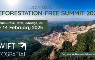
Swift Geospatial is attending the Deforestation-Free Summit 2025 on February 13–14 in Uxbridge, UK, where Michael Breetzke will present a case study on a successful deforestation monitoring project. Learn how GIS and satellite imagery support EUDR compliance and proactive deforestation risk management. Visit our booth to explore how our cutting-edge monitoring solutions enhance supply chain due diligence and sustainability efforts.

The Evolution of GIS: Aerial Photography and the Mapping Revolution – Part 1

Let’s take a decade-by-decade walk into the history books and discover the evolution of GIS and the critical role of aerial photography in its growth into a vital element of today's technological driven society.

Meet us at the Deforestation-Free Summit 2025

Swift Geospatial is excited to participate in the Deforestation-Free Summit 2025, where Co-founder Michael Breetzke will present a case study on successful deforestation monitoring using satellite technology. With the upcoming EU Deforestation Regulation (EUDR), Swift Geospatial is ready to support companies in meeting compliance standards and advancing their sustainability goals.

Wyvern: The Future of Geospatial Intelligence with Advanced Satellite Constellation

We're on the brink of a new era in satellite technology, and the Wyvern Constellation is leading the charge. This groundbreaking advancement is set to revolutionize the way we observe and interact with our planet. Whether it’s tracking environmental changes, boosting agricultural efficiency, managing resources, or enhancing national security, Wyvern's high-resolution data is changing the game.

The cocoa price hike, its impact on smallholder farmers and EUDR

The cocoa industry is grappling with an unprecedented crisis as cocoa prices skyrocket, doubling since the beginning of the year, as key producing countries in Africa are hard-hit by extreme climate change events, outbreaks of disease impacting crops and financial uncertainty. How have smallholder cocoa farmers been impacted and what can be done to help them? How does the EU Deforestation Regulation factor into this, given that cocoa is listed as one of the high-risk deforestation commodities?

How will the EU Deforestation Regulation impact smallholder farmers?

The European Union Deforestation Regulation (EUDR) implementation deadline is fast approaching on 30 December 2024. Can smallholder farmers rally to meet the regulation requirements while under such time pressure, and facing other challenges such as a lack of financial resources, and technological and regulatory support?

As global demand for soy and cattle increases, how can EUDR and other legislation help prevent negative climate impacts?

In a world where deforestation management and climate conservation are becoming increasingly pressing, soybean production and cattle farming are being spotlighted. Regulations like the European Union Deforestation Regulation (EUDR) and others are helping combat unsustainable soybean and cattle farming practices, but how are they faring as demand for these commodities rises globally?

The impact of EUDR on top deforestation commodities: Cocoa and coffee

The EU Deforestation Regulation (EUDR) is a crucial measure to reduce global deforestation caused by major EU-imported goods and commodities. Two of the top deforestation drivers include cocoa and coffee. Find out more about these commodities, their impact and what EUDR hopes to achieve as well as how Swift Geospatial is able to assist in the monitoring of cocoa plantations across the globe.

How Can Swift Geospatial play a role in EUDR Compliance?

EUDR aims to curb deforestation, forest degradation, and general environmental and human rights infractions in the production and consumption of certain imported and exported goods and commodities within the EU. Find out more about EUDR, why it matters and how Swift Geospatial can assist your business compliance through GIS and remote sensing solutions.

The Importance of Monitoring Change

Because more and more people are living in cities, this means that cities are growing and changing all the time. To manage this growth, we need to monitor change detection in cities to see what’s happening and what we need to do. Change detection monitoring means comparing pictures of cities taken from satellites or planes at different times to see what has changed, like new buildings, land use changes, or changes in green areas.

Go to Top