Satellite Imagery Procurement
High resolution satellite imagery procurement is available for purchase from the world’s top satellite imagery companies. Providing unparalleled image data to be used in our custom GIS monitoring, earth observation and change detection remote sensing solutions.
High-Resolution Satellite Imagery Procurement Solutions by Swift Geospatial
At Swift Geospatial, we provide seamless access to high-resolution satellite imagery from leading providers, including Maxar Technologies, Planet Labs, and Capella Space. Our solutions are designed to meet the unique needs of industries such as agriculture, mining, forestry, urban planning, and environmental monitoring. Whether you’re tracking land-use changes, monitoring crop health, or conducting real-time disaster assessments, we deliver precise, reliable, and timely data to support your decision-making processes.
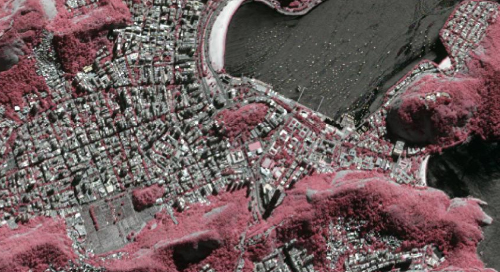
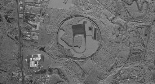
Through partnerships with Maxar Technologies, we offer access to unparalleled high-resolution imagery from their advanced WorldView and GeoEye satellite constellations. For frequent, near-daily monitoring, Planet Labs’ Dove and SkySat constellations provide agile, comprehensive Earth observation, perfect for applications requiring consistent updates. Additionally, with Capella Space, we deliver cutting-edge synthetic aperture radar (SAR) imagery, enabling precise data collection even through cloud cover or at night. Our procurement services ensure you get the best imagery tailored to your operational needs, seamlessly integrated into your GIS workflows for actionable insights.

Archive Satellite Monitoring Imagery
With full access to the entire DigitalGlobe and Planet archive, Swift can source any image form over 1 billion square kilometres. Please enquire to check the coverage over your area of interest.

New Tasking Of Satellite Imagery
If your project needs up to the minute information, or repeat collects of data to detect and measure what’s happening on the ground, then New tasking of one of DigitalGlobe’s advances satellites is the answer. With new tasking capabilities of up to 30cm, daily repeats, and advanced modes such as stereo, your projects needs will be met.

Full Range Of Remote Sensing Services
The remote sensing services Swift Geospatial offers take satellite imagery and add a number of value added benefits. These include vegetation studies, mineral exploration, change detection and many more.
Satellite Imagery Services

How it works?
Decipher your area of interest
Where in the world are you looking to focus your monitoring?
Analyze
your needs
Swift Geospatial is able to provide satellite imagery resolution best suited to your needs
Imagery
frequency
How often do you require imagery to be taken to monitor change?
Imagery Providers


Maxar Satellite Imagery Procurement
Maxar Technologies is a global leader in satellite imagery, offering high-resolution Earth observation data that supports industries ranging from agriculture to defense. Their advanced satellite constellation, including the WorldView and GeoEye series, provides unparalleled clarity and detail for applications like land-use mapping, disaster response, and urban planning. Organizations can procure imagery tailored to specific needs, such as current captures or extensive archives, enabling precise insights and analysis.


Planet Labs Satellite Imagery Procurement
Planet Labs specializes in providing frequent, high-resolution satellite imagery, offering a near-daily view of every location on Earth. Known for their agile Dove and SkySat satellite constellations, Planet Labs is ideal for monitoring dynamic environments like agricultural fields, forests, and urban developments. Their user-friendly platform enables quick procurement of imagery for real-time monitoring or historical analysis.
By delivering continuous and comprehensive Earth observation data, Planet Labs empowers organizations to detect changes, manage resources, and adapt to evolving challenges with unmatched efficiency. Their commitment to democratizing satellite imagery makes advanced geospatial intelligence accessible to a broader range of users and industries.


Capella Space: Precision Imagery with Synthetic Aperture Radar (SAR)
Capella Space delivers cutting-edge satellite imagery through its advanced synthetic aperture radar (SAR) technology, providing unmatched precision and reliability. Unlike traditional optical satellites, Capella’s SAR sensors capture high-resolution images regardless of weather conditions or time of day, making them ideal for applications in dynamic and challenging environments. From monitoring infrastructure and detecting deforestation to assessing disaster-affected areas, Capella Space’s data empowers industries with actionable insights. Their on-demand tasking capabilities and rapid delivery ensure users receive the most current and accurate information, revolutionizing how organizations monitor and respond to changes on Earth.
| Provider | Satellite/Product | Bands | Details |
|---|---|---|---|
| Planet | Dove/Daily | 8-Band | Provides daily, high-frequency multispectral imagery for monitoring and analysis. |
| Planet | Skysat | 4-Band (RGB, NIR) with optional Panchromatic Band | Offers higher-resolution imagery, with RGB and NIR for vegetation health and panchromatic for enhanced detail. |
| MAXAR | WorldView Series | 1 to 16 Bands (includes SWIR, NIR, and RGB) | Wide band selection, including Shortwave Infrared (SWIR) for material identification, NIR for vegetation health, and RGB for visual analysis. |
| Capella Space | Synthetic Aperture Radar (SAR) | X-Band, Single-Frequency Radar | High-resolution radar imagery unaffected by weather or lighting conditions, supporting spotlight, sliding spotlight, and stripmap modes for diverse use cases. |
